
- Apply
- Visit
- Request Info
- Give

Written by Molly Boucher
Published on November 15, 2019
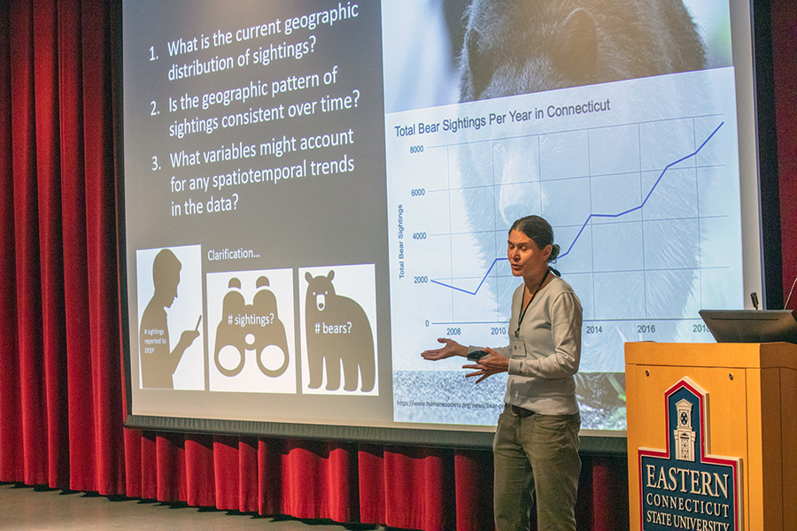
Kim Diver from Wesleyan University presents "Spatiotemporal Patterns of Reported Black Bear Sightings in Connecticut, 2007-2019."
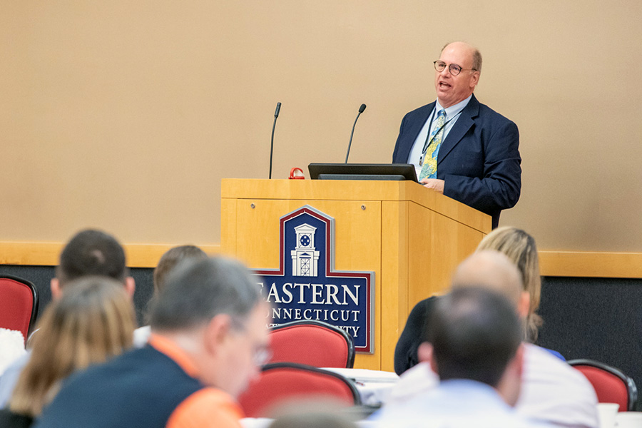
Professional Land Surveyor, Richard Vannozzi presents his keynote speech.
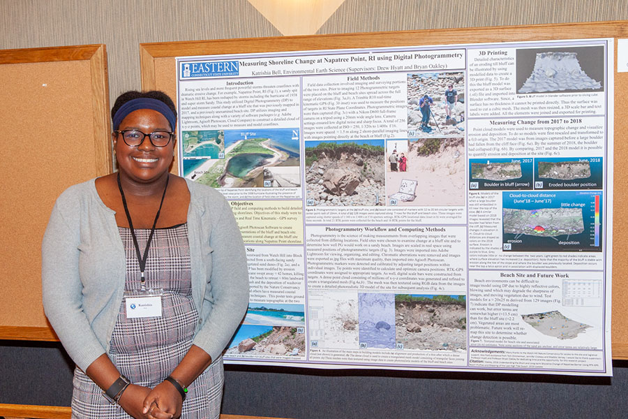
Eastern student Katrishia Bell presents her research poster titled, "Measuring Shoreline Change at Napatree Point, RI Using Digital Photogrammetry."
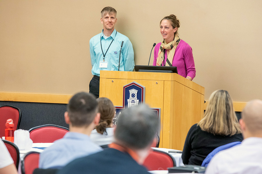
GIS Lecturer Aaron Nash and EES Professor Meredith Metcalf deliver GIS Day opening remarks.
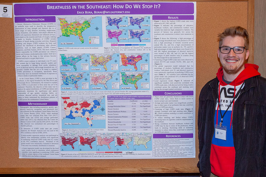
Eastern student Erick Bora presents his research poster titled, "Breathless in the Southeast: How Do We Stop It?"
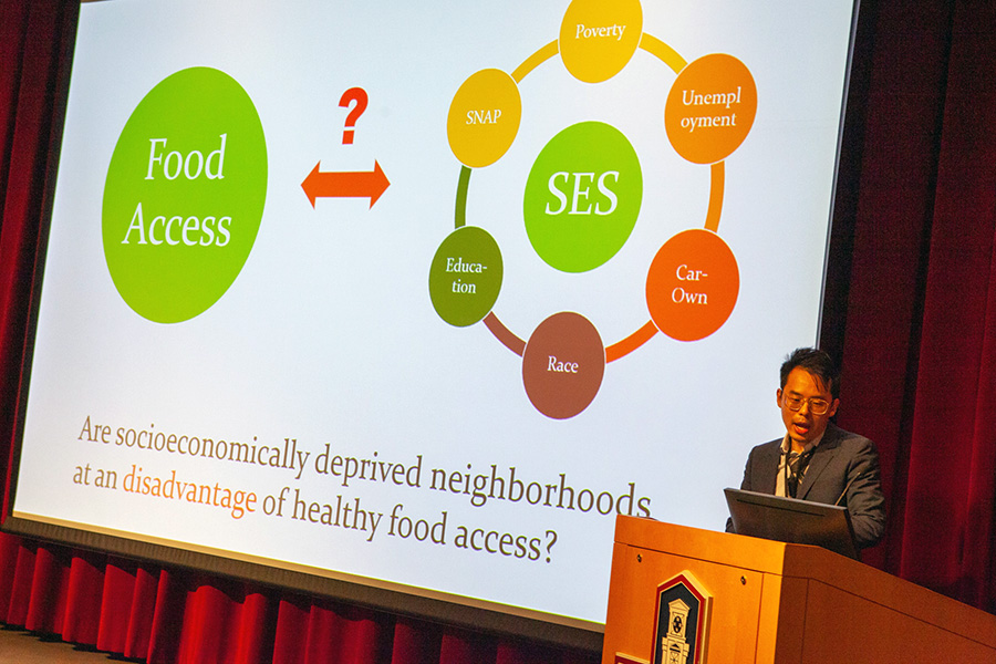
Xiang Chen from the University of Connecticut presents his presentation title, "Geovisualizing Space-Time Access to Food Retailers."
Eastern Connecticut State University hosted Geographic Information Systems (GIS) Day on Nov. 13. The event was held in the Student Center with approximately 140 attendees, including government officials, consulting and engineering firms, professors and students. The day included a panel from workers in the GIS field along with research presentations and a keynote speaker. There were also interactive events such as voting for the new GIS poster and logo, GIS Day Vendor Bingo and Geography Jeopardy at lunch. The goal of the event was to bring local GIS professionals to campus to share their research and work.
GIS technology stores, checks and displays geographical data in relation to other forms of information. GIS programs make connections between land and population, income or education levels. The goal of GIS systems is to connect geography to human functions, GIS range from finding pollution sites to mapping 9-1-1 calls.
The event opened with welcomes from Provost William Salka, Environmental Earth Science Professor Meredith Metcalf and Lecturer Aaron Nash, president of the GIS User Network. Salka reminded guests that Eastern offers a GIS minor, and the University is working towards creating a GIS certificate. Nash informed guests that GIS is developing into an international movement, with millions of users around the world. This is the 18th year of GIS day in Connecticut since its creation in 2001, when it was hosted at the Legislative Office Building in Hartford as a means to educate legislators about the uses of GIS.
Richard Vannozzi, a professional land surveyor in Massachusetts and professor of land surveying at the University of Maine, presented his research during his keynote speech, “The Roaring 2020s... The Decade of the Parcel.” The speech, which focused on the most exact form of land surveying-the parcel was a commentary on human nature and its relationships to geography. “Human nature takes us to the thing nearest to our hearts--land ownership,” said Vannozzi. “Society wants an authoritative and precise land boundary layer.” He also commented on while GIS is developing in multiple fields, it is rare that a land surveyor such as he enjoys the system. “Color maps hold my interest more than black and white maps.”
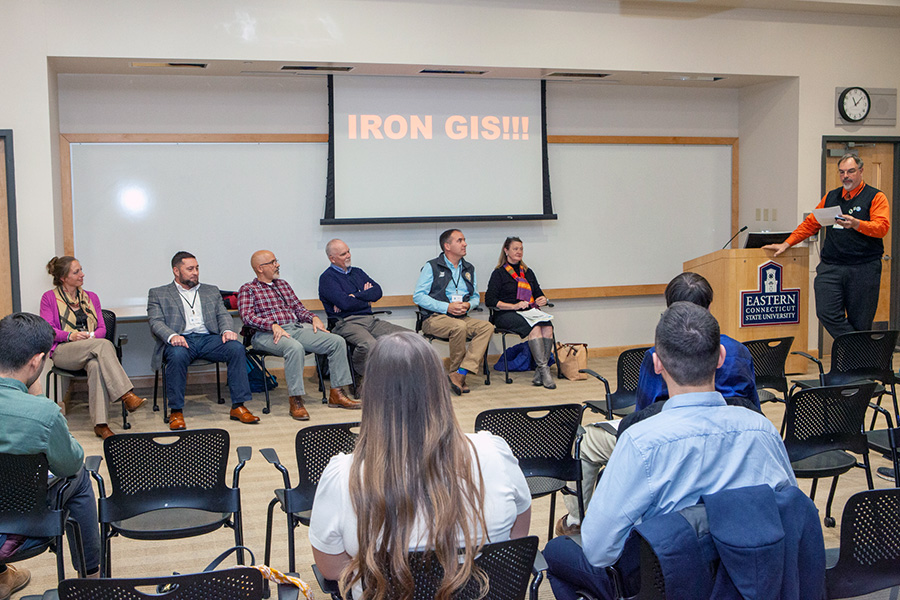
A panel was held halfway through the event for those who wanted to learn more about career opportunities in GIS. Professionals on the panel included Ed Juarbe, Patrick Lad, Dan Czaja, Jason Courter, Liz Cruthere and Meredith Metcalf. When asked for a definition of GIS, Lad responded by saying, “I connect people, places and things.” “I think it’s an incredibly powerful way to solve most problems,” said Metcalf. All the panelists commented that they were in awe of GIS when they first started, “I’m amazed by how little I have to get out of my chair to find information,” said Czaja.
When asked what advice they had for students considering a career in GIS, all agreed that students need to be open to new opportunities. “Be flexible and learn as much as you can,” recommended Juarbe, while Metcalf advised students to “take on challenges and accept them.” Lad also pushed the idea of getting experience as early as possible. “I don’t know if I could’ve gotten into the field without internships.” When the panel was asked what classes outside of information technology and geography would be helpful to students interested in the GIS field, answers included statistics, art, design, technical writing and data management. Metcalf also encouraged students to be “creative and step outside of the box.”
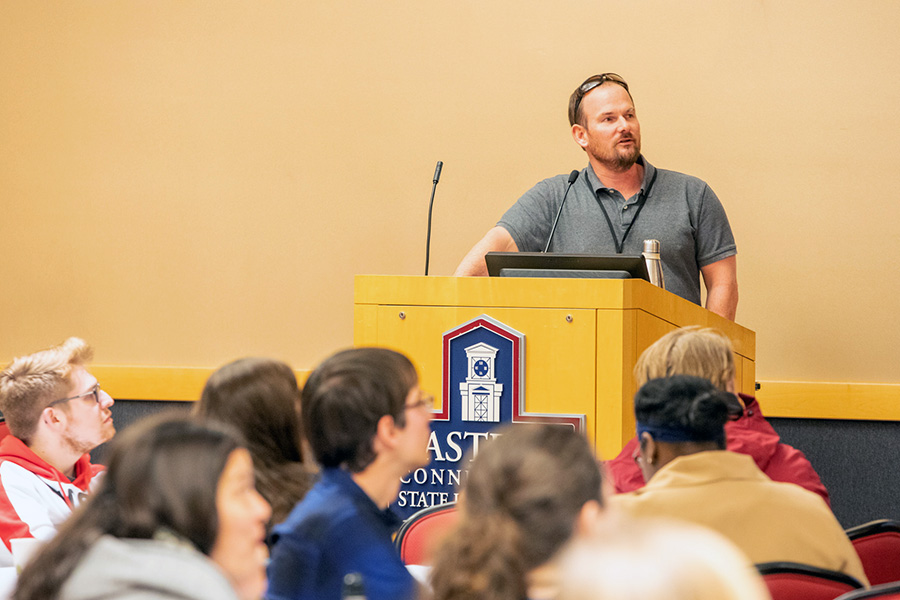
Environmental Earth Science Professor Bryan Oakley also presented at GIS Day, speaking on the topic, “Using GIS in Coastal Geology: Applied Projects from the Rhode Island Shoreline Change Special Area Management Plan.” “I’m a geologist, but I use GIS,” said Oakley, who’s been measuring storm surge damage, coastal erosion and sea-level rise over the past several years to track shoreline change in Rhode Island.
“Shorelines are retreating; basically everything is eroding,” he said. Through tracking the wet-dry line on the beach and comparing measurements with historical photographs, Oakley has determined that the shoreline has retreated by nearly 90 meters over the past 65 years in certain areas. The goal of this research, he says, is to inform stakeholders of accelerating sea level rise, including local governments, homeowners and developers.
GIS Lecturer Aaron Nash presented “ADA Curb Ramp Assessment” with Jessica Mercier of the engineering firm BETA Group. Their work involves using GIS to ensure that the City of Hartford’s handicap ramps, guard rails, street signs and other assets are ADA compliant.