- Apply
- Visit
- Request Info
- Give


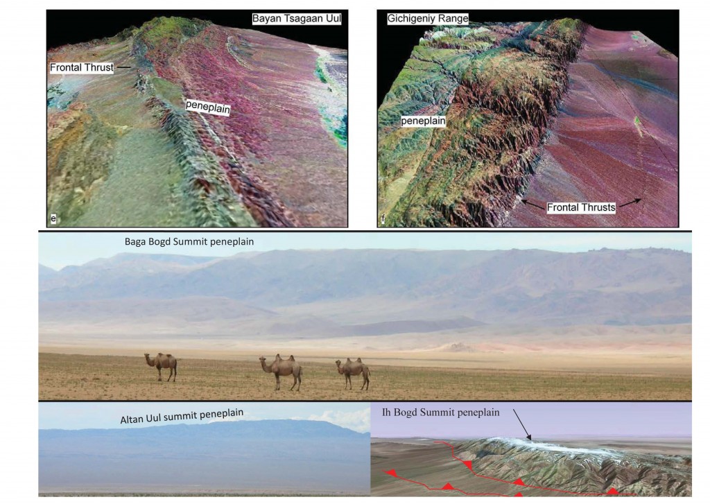
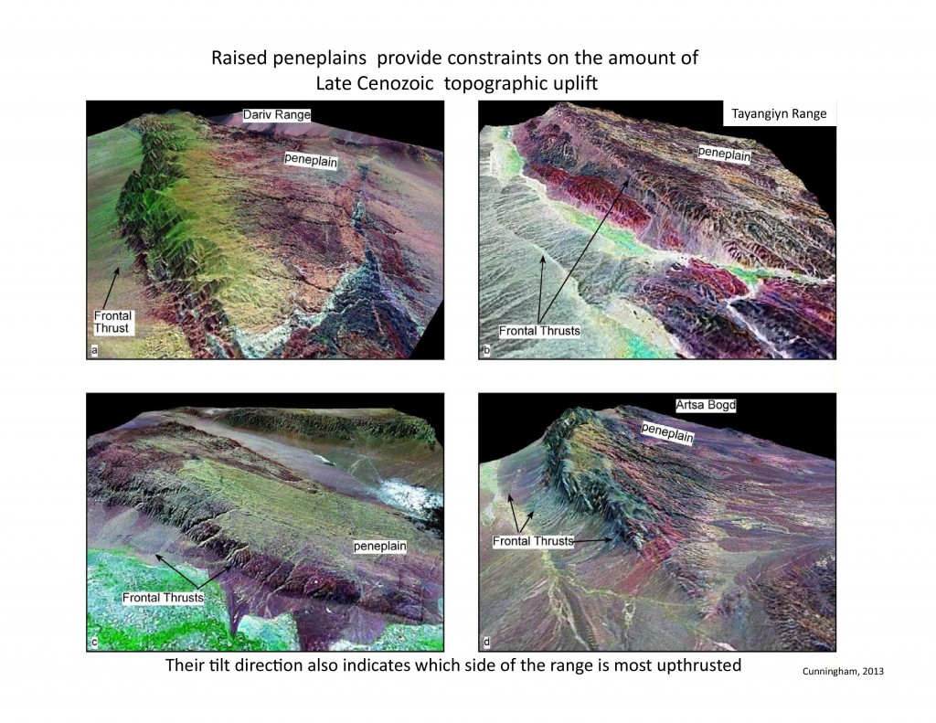
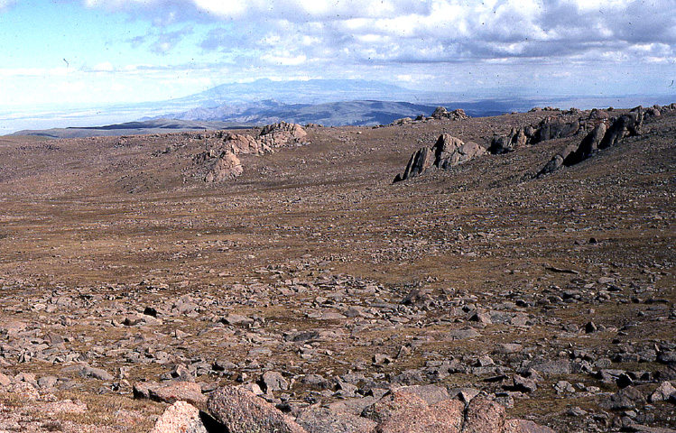
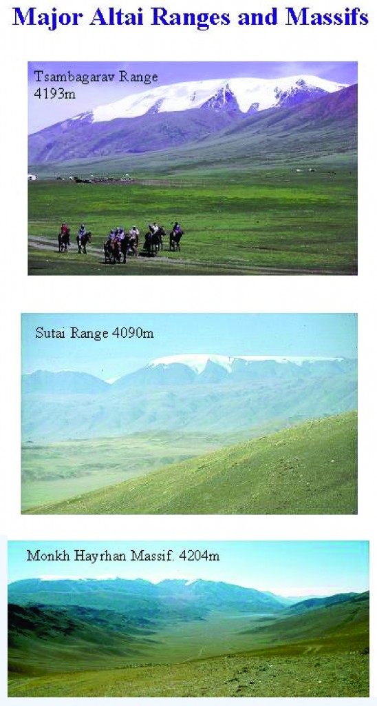
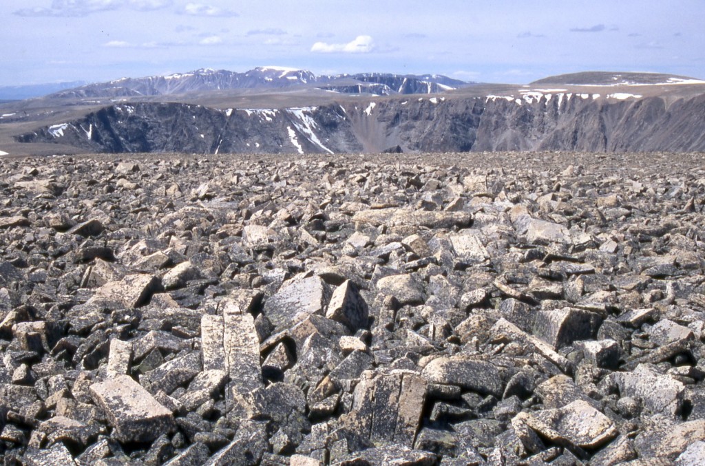
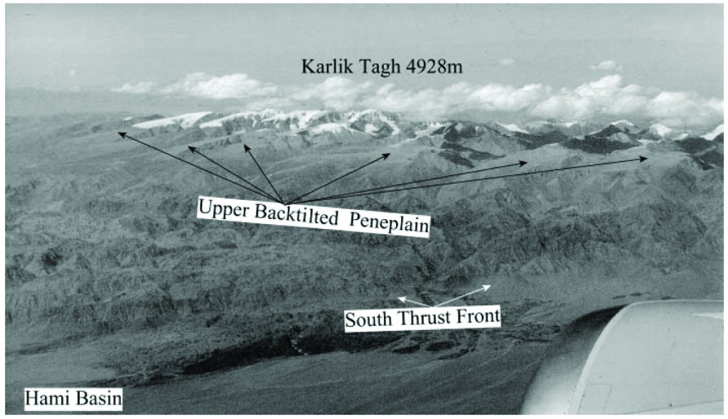
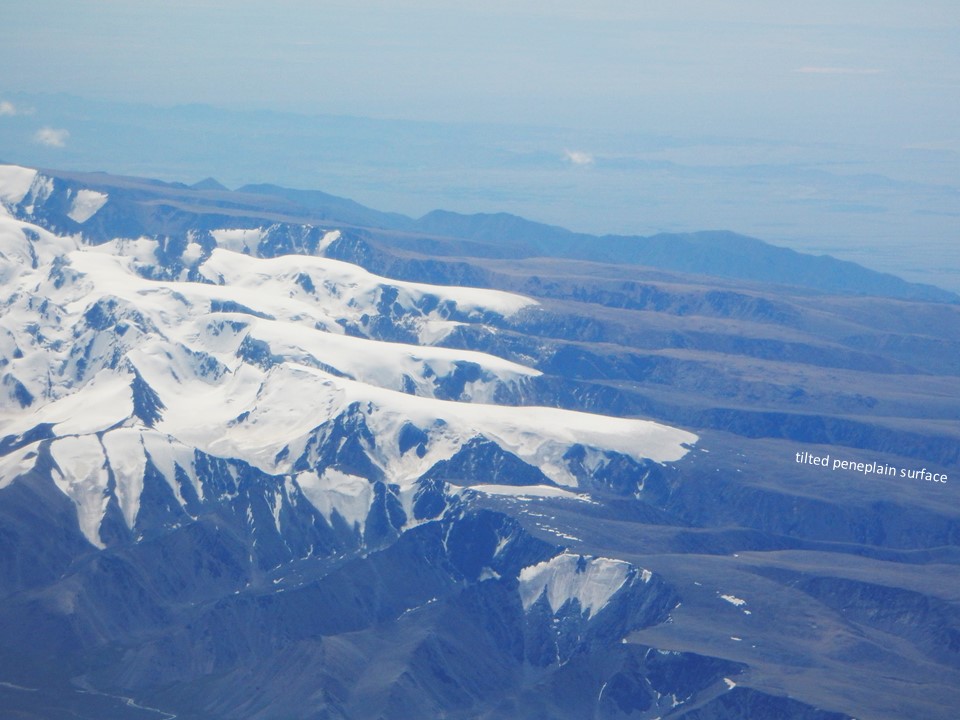
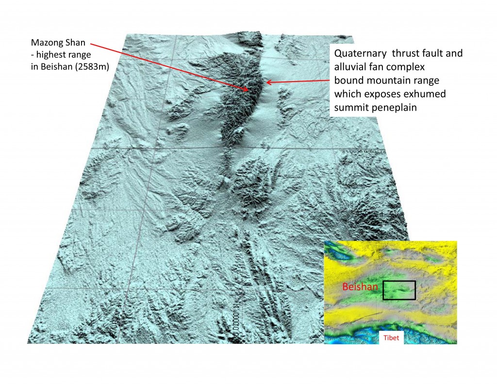
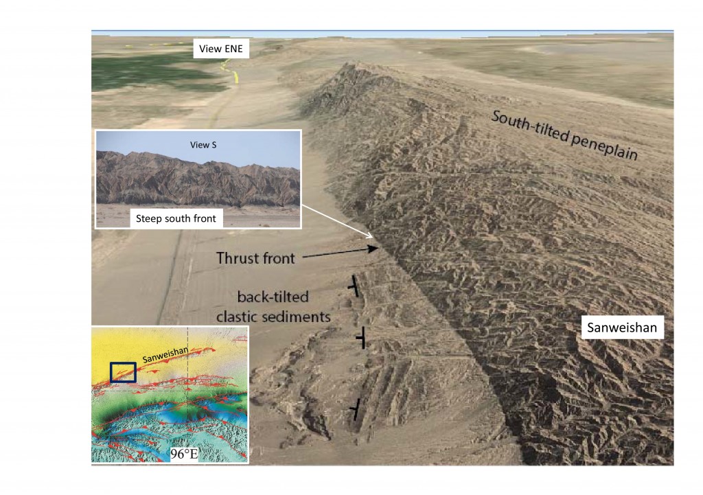
This page shows field photos and satellite images of peneplained summits in the Gobi Corridor region which encompasses the Gobi Altai, SE Altai, Easternmost Tien Shan, Beishan and north Tibetan Foreland. The mountains in the Gobi Corridor are typically Pliocene-Recent uplifts that have formed in a region that typically receives only 50-200mm/yr of rainfall. The tectonic signal is strongly expressed in the landscape because erosion rates are low. There are no river outlets and intramontane basins typically are internally drained. Pleistocene-Recent glaciation is/was minimal and only found in the easternmost Tien Shan and parts of the SE Altai. The mountains are so young that they have not yet had their summits eroded into higher relief landscapes and jagged peaks. The peneplain summits represent an uplifted Jurassic-Cretaceous erosion surface typically 500m-4kms above regional base level. They were described long ago and are a hallmark of much of the mountainous terrain north of Tibet.
For further discussion, see:
Berkey, C.P., and F.K. Morris, 1924. The peneplanes of Mongolia. American Museum Novitates, Number 136, p. 1-11.
Jolivet, M., Ritz, J. F., Vassallo, R., Larroque, C., Braucher, R., Todbileg, M., Chauvet, A., Sue, C., Arnaud, N., De Vicente, R., Arzhanikova, A., and Arzhanikov, S., 2007. Mongolian summits: An uplifted, flat, old but still preserved erosion surface. Geology 35, 871-874.
Cunningham, D., 2013, Mountain building processes in intracontinental oblique deformation belts: Lessons from the Gobi Corridor, Central Asia, Journal of Structural Geology, Vol. 46, 255-282.