Skip to Main Site Navigation Skip to Content Skip to Footer
Back To Top

Connecticut Geology


x
kyanite and garnet in quartz vein and schist, Harwinton, CT


Connecticut Geology


Useful Web Sites and Field Photos (scroll down)


1) Bedrock Geological Map of Connecticut (via Talcott Mtn Science Center):
http://cteco.uconn.edu/maps/state/Bedrock_Geologic_Map_of_Connecticut.pdf


2) Connecticut Geological Survey (Publications, maps, State Park geology info and much more:
http://www.ct.gov/deep/cwp/view.asp?a=2701&q=487928&deepNav_GID=1641%20


3) USGS in CT (CT and NE USA geological information): https://www.usgs.gov/science/regions/northeast?qt-regions_l2_landing_page_tabs=0#qt-regions_l2_landing_page_tabs


4) Wesleyan University Geology Museum: https://www.wesleyan.edu/ees/museum1.html


5) Long Island Sound and surrounding regions - geological history:http://www.lisrc.uconn.edu/lisrc/geology.asp?p2=History&p3=glhct


6) Connecticut GIS Layers (from UCONN MAGIC distribution page): http://magic.lib.uconn.edu/connecticut_data.html#environmental


7) USGS downloadable GIS data files, New England states:https://pubs.usgs.gov/of/2004/1258/HTML/NE_data.htm  

8) Connecticut Earthquake Information:https://search.usa.gov/search?utf8=%E2%9C%93&affiliate=usgs&sitelimit=https%3A%2F%2Fearthquake.usgs.gov&query=connecticut

9) Long Island Sound Resource Center - M.Coleman's tectonic history diagrams: http://www.lisrc.uconn.edu/lisrc/geology.asp


10) New England and central Appalachian DEM: http://www.jamestown-ri.info/appalachian_chain.jpg

11) LiDAR Hillshade Image (Gigapan image with zoom capability - stunning!)
http://www.gigapan.com/gigapans/93443

12) Connecticut Glacial Lakes Map: http://70.91.221.154/geology/ct_glac/


13) Connecticut Mineral Localities (Mindat list with descriptions):https://www.mindat.org/lsearch.php?from=nsearch&loc=connecticut

14) Connecticut bedrock mines and quarry map (Zoom in for excellent detailed information): https://www.mindat.org/lsearch.php?from=nsearch&loc=connecticut

15) Connecticut Garnet Trail: http://www.ct.gov/deep/lib/deep/gis/garnettrail/ctgarnettrail_all.pdf


EASTERN CONNECTICUT GEOLOGY PHOTOS


Eastern Connecticut has many spectacular outcrops of the metamorphic, polydeformed core of the New England Appalachians. Below are some field photos taken during my first few years exploring the eastern half of the state.

g
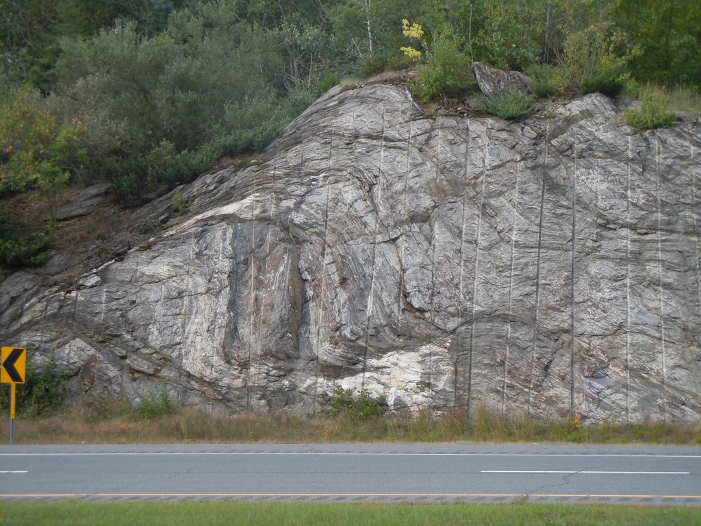
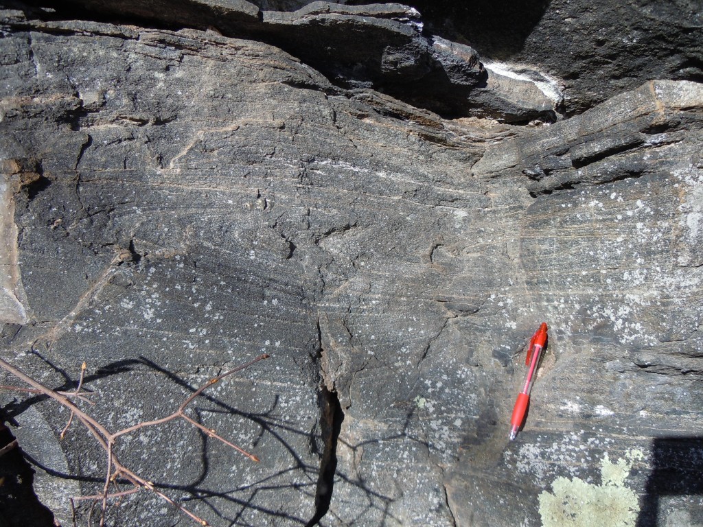
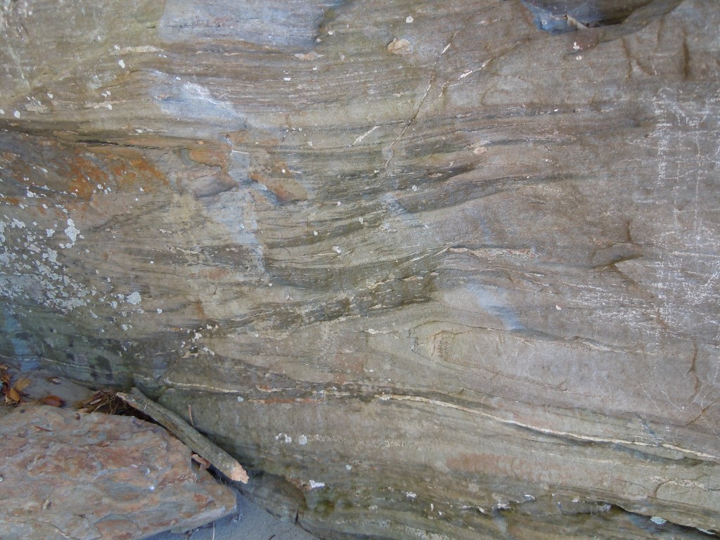
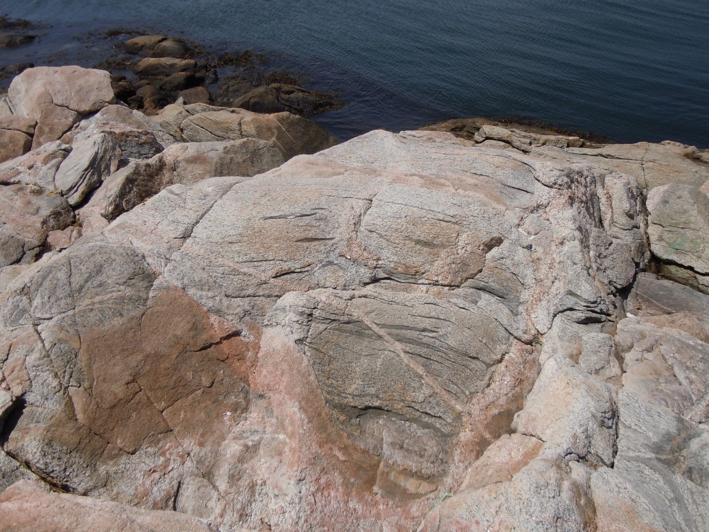
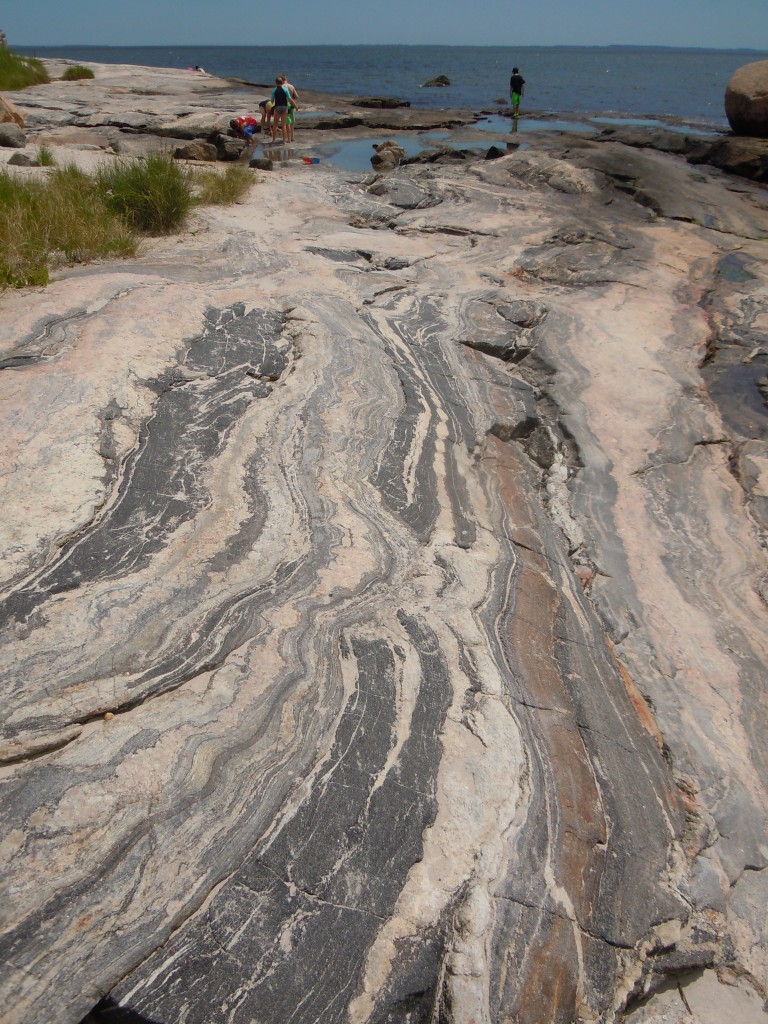
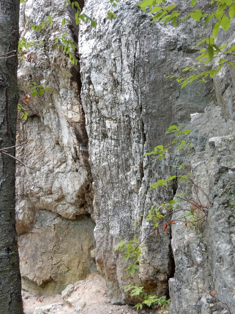
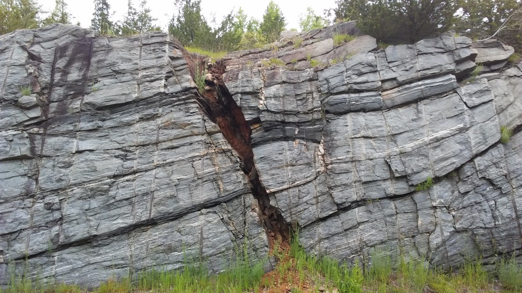
extensional shear zone, Willimantic, CT


g
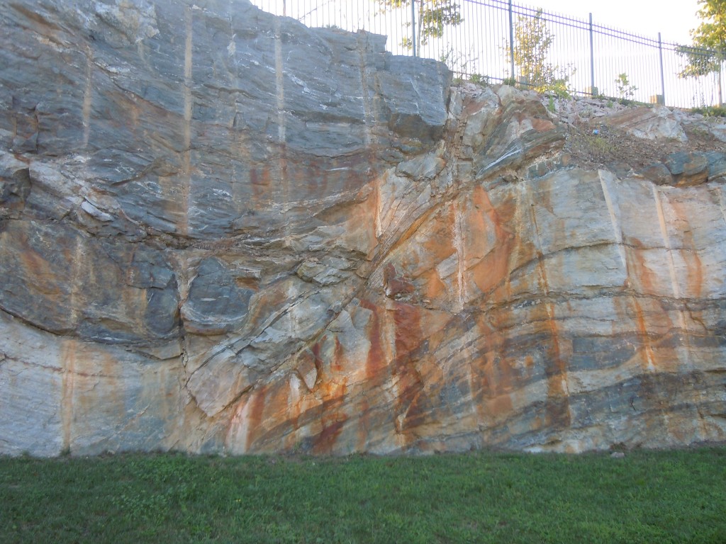
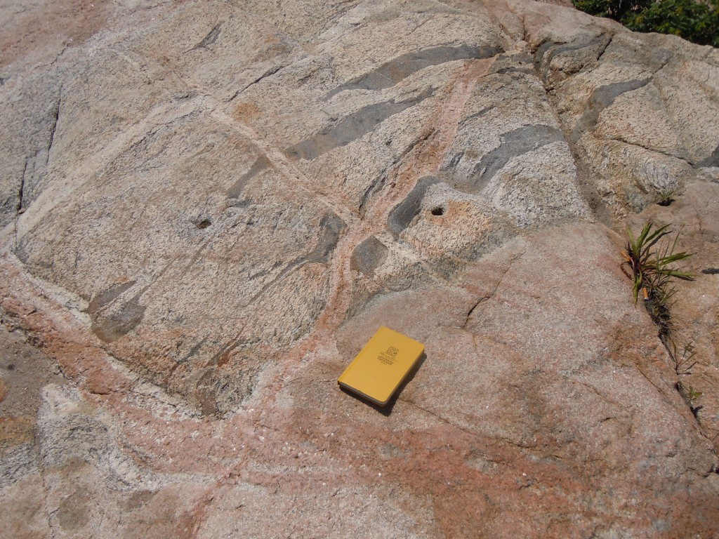
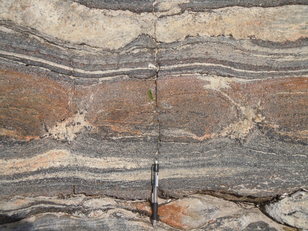
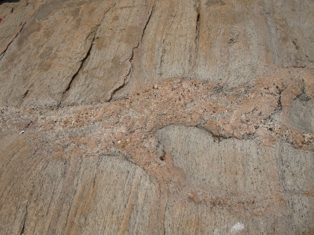
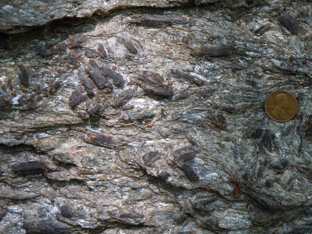
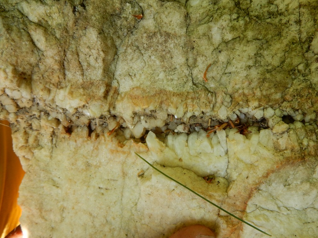
stunning pegmatite boudinage, Salem, CT


f
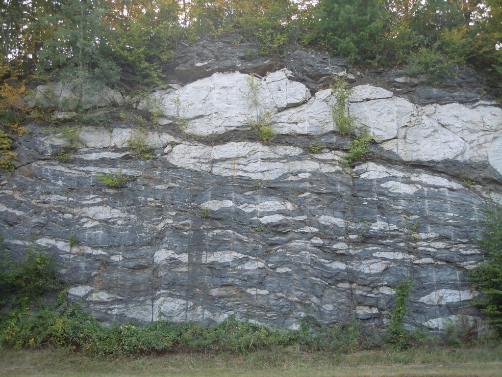
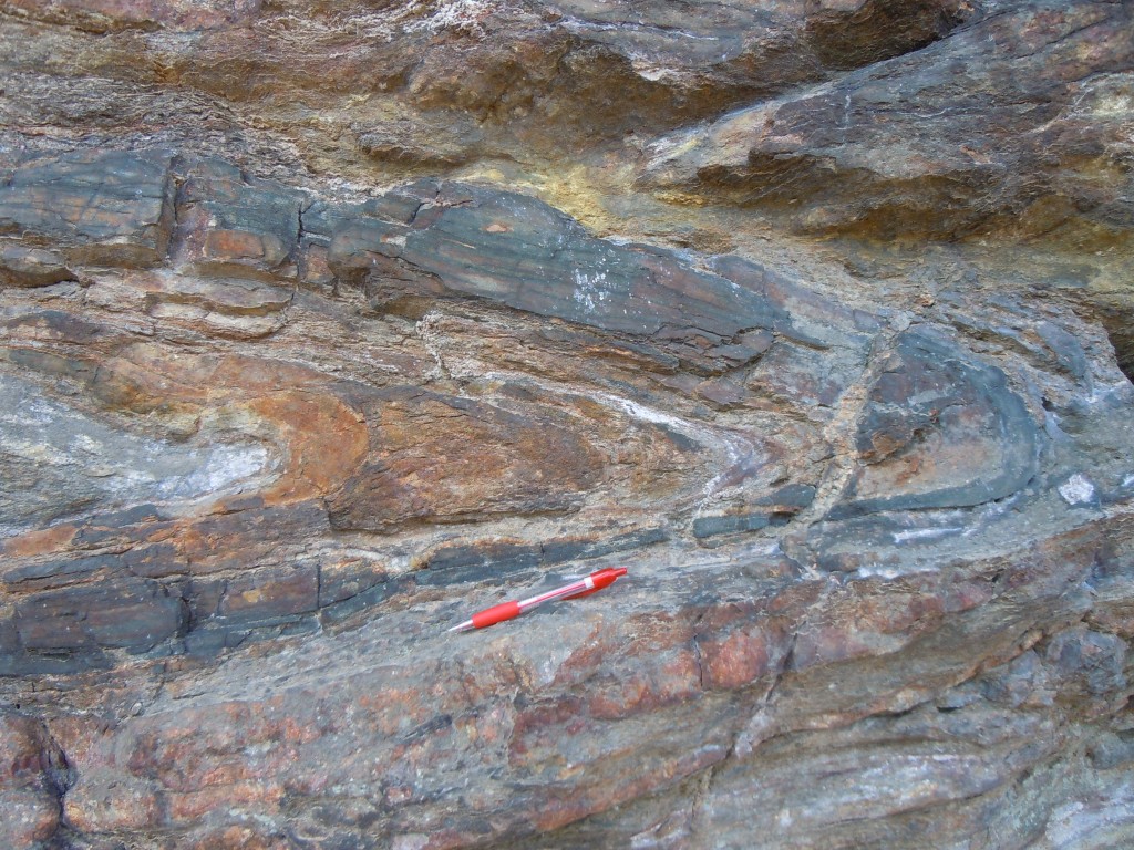
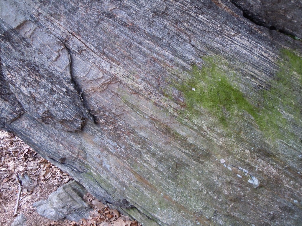
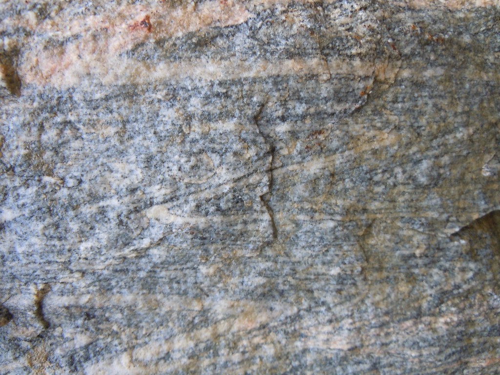
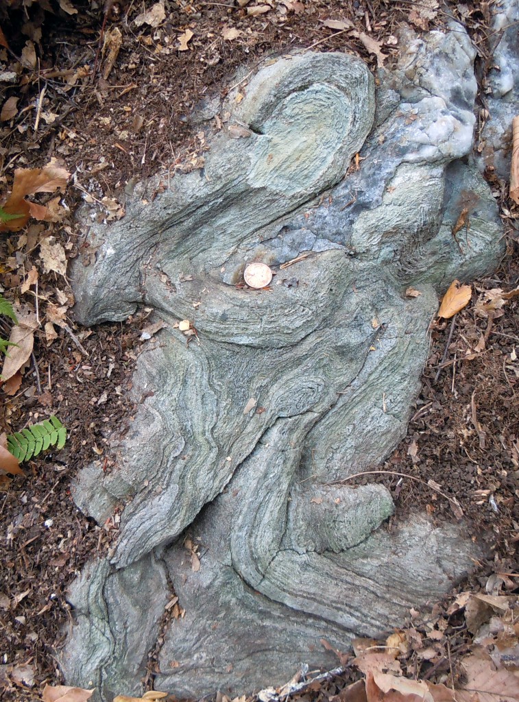
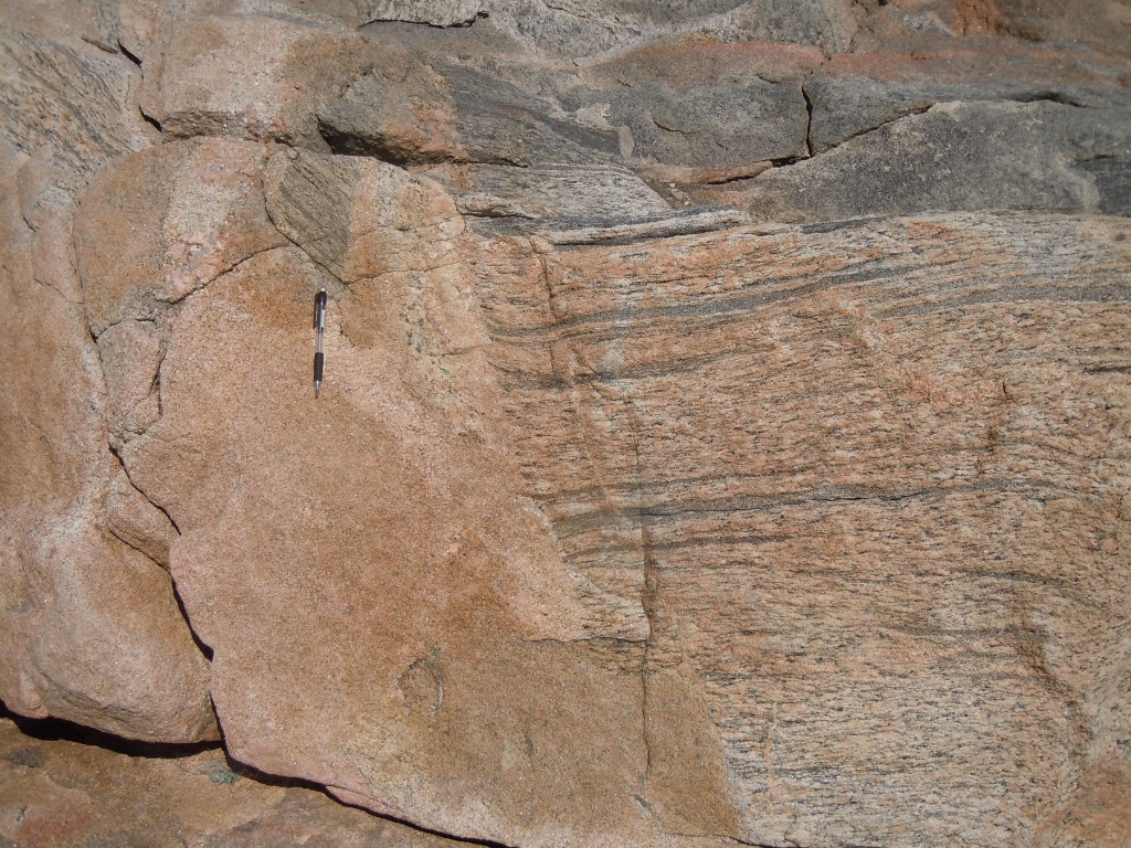
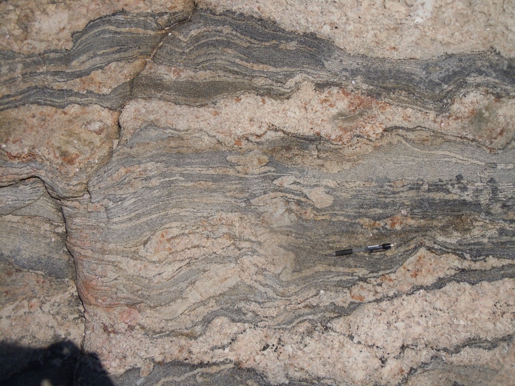
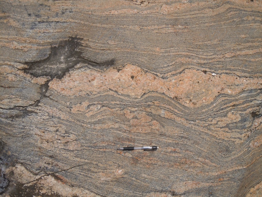
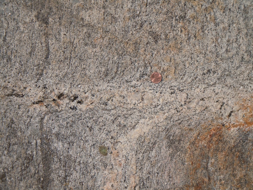
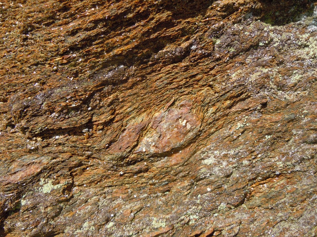
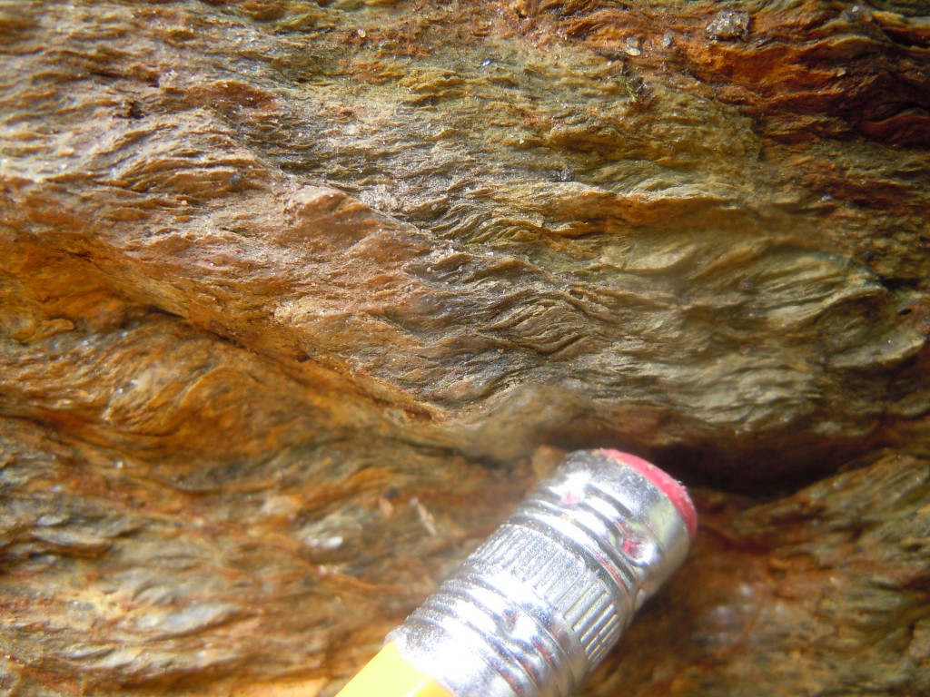
close-up of extensional shear zone, Lisbon, CT


s
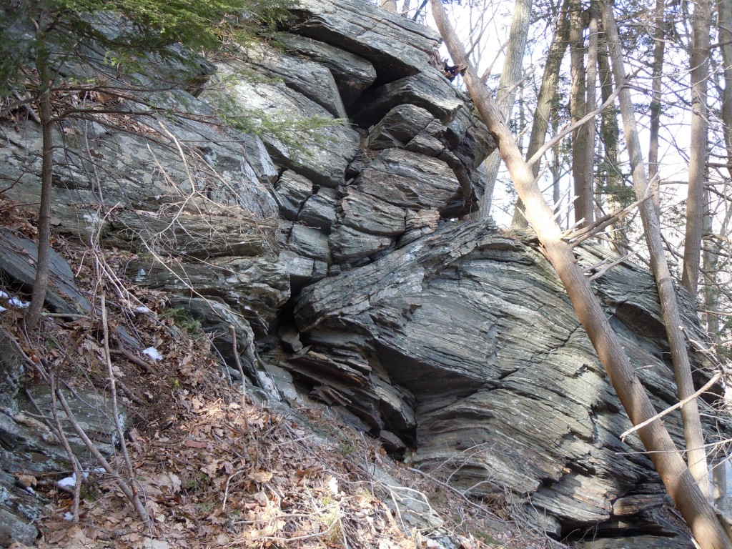
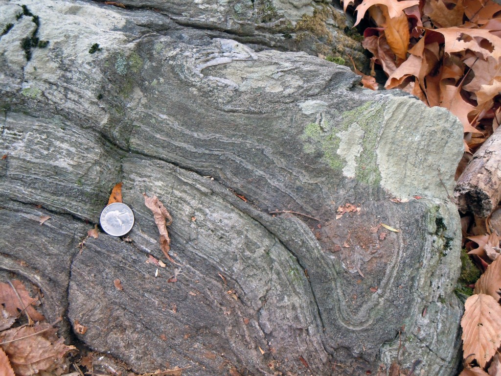
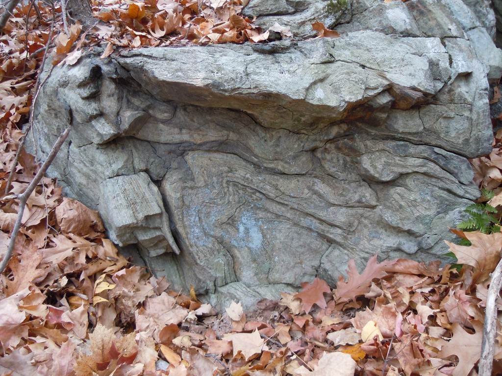
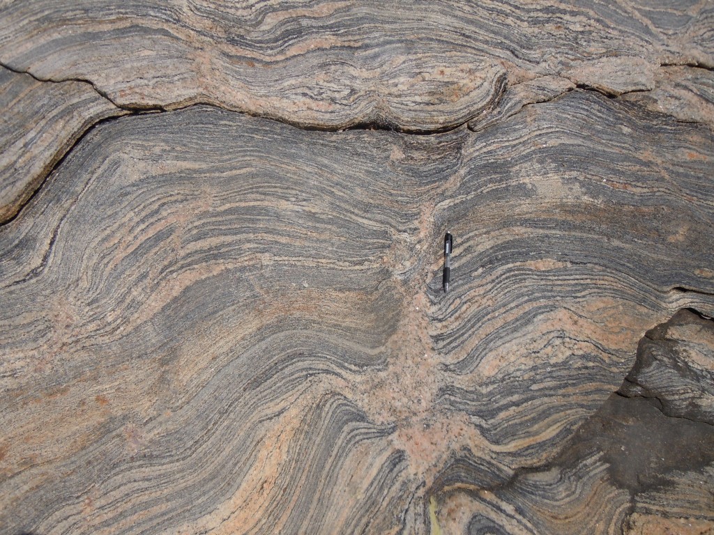
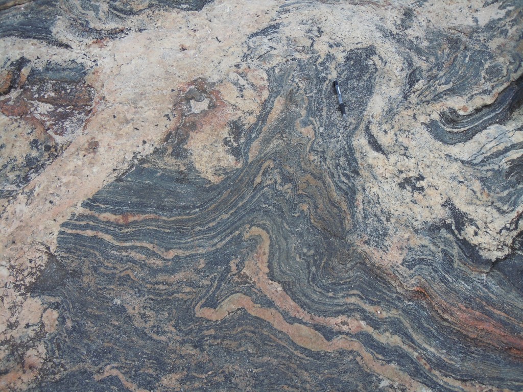
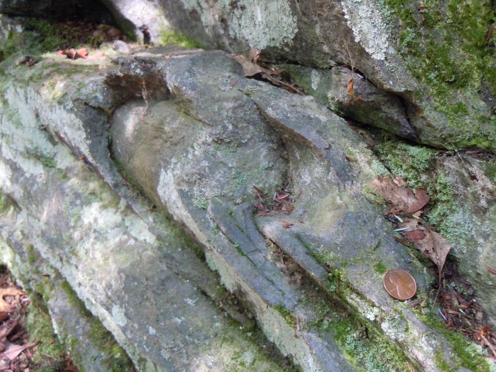
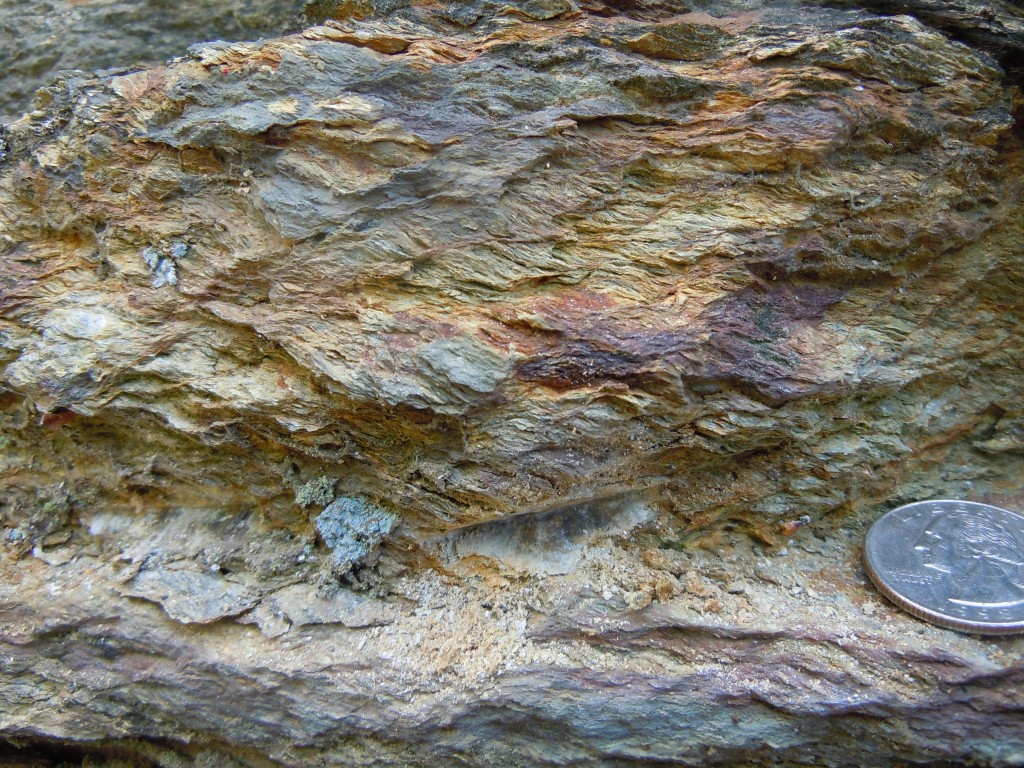
sheath fold, Coventry, CT


c
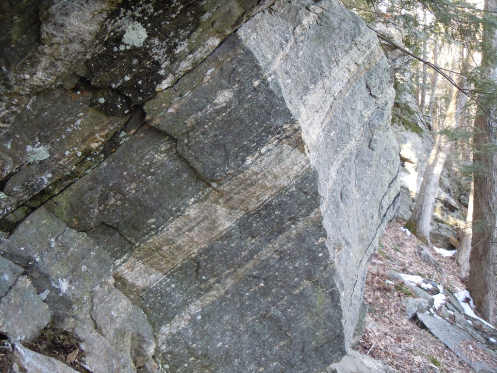
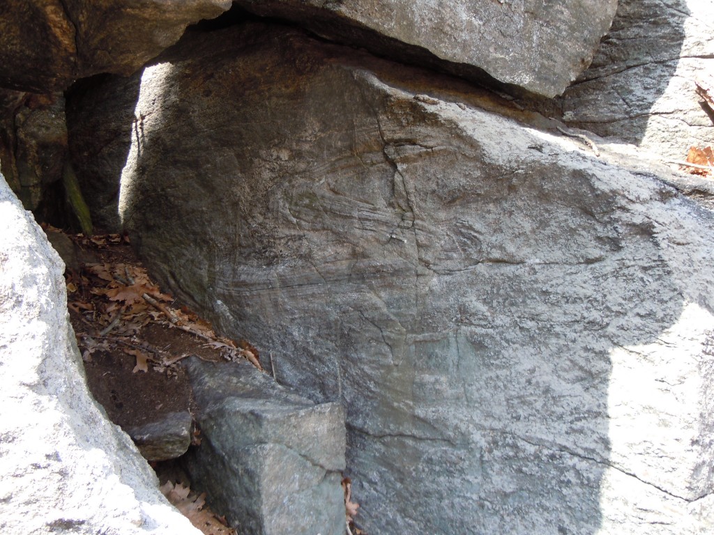
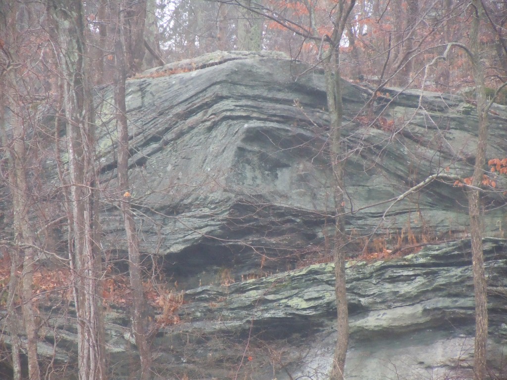
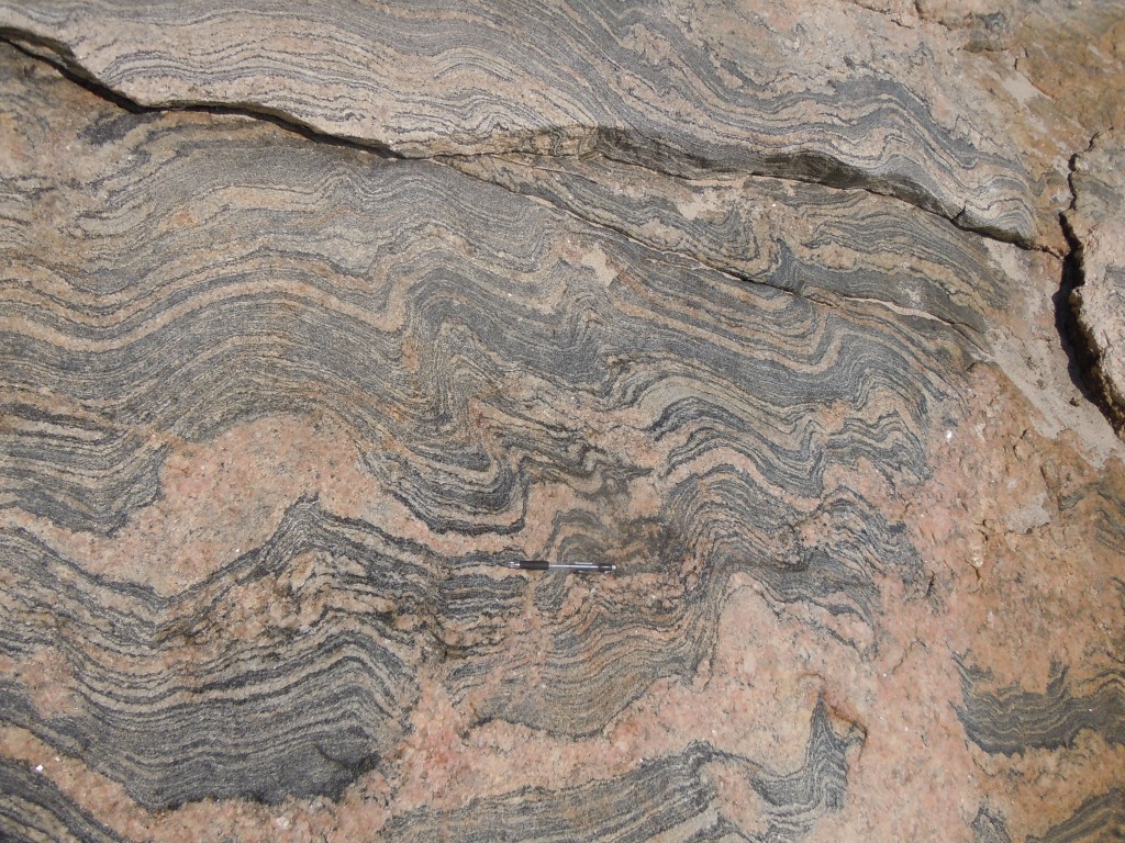
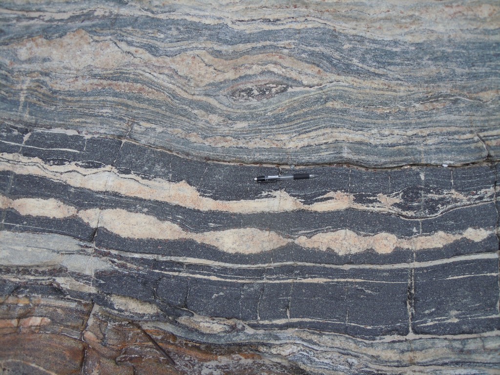
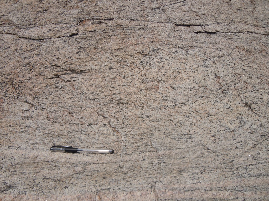
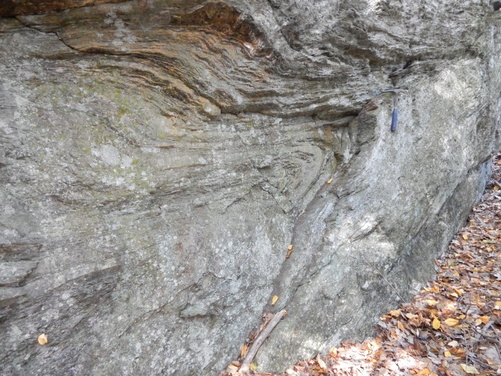
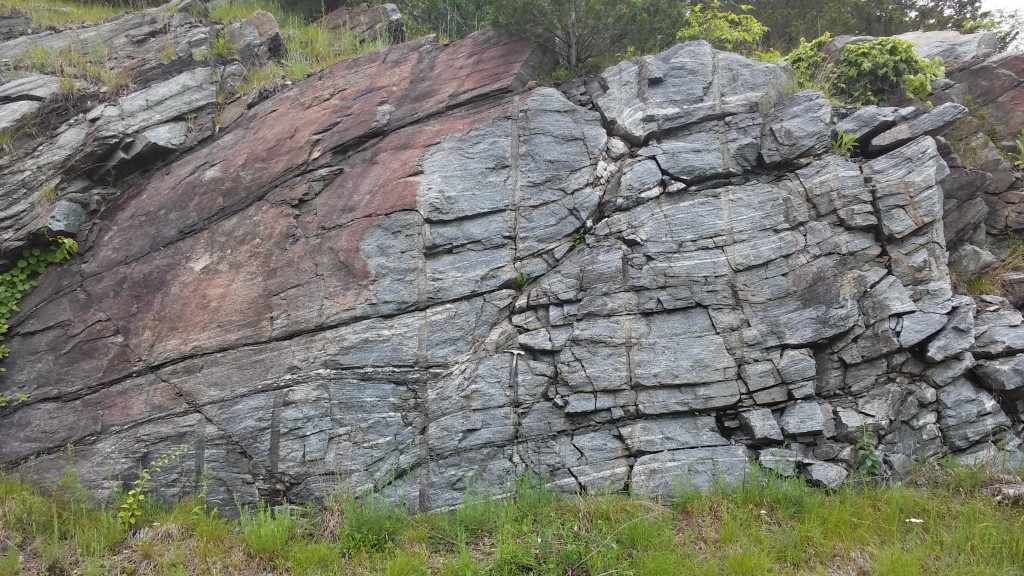
extensional shear zone, Coventry, CT


d
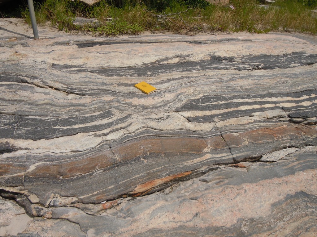
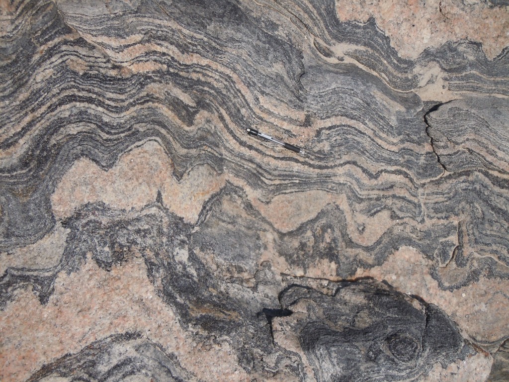
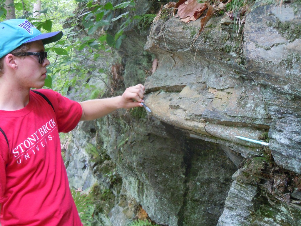
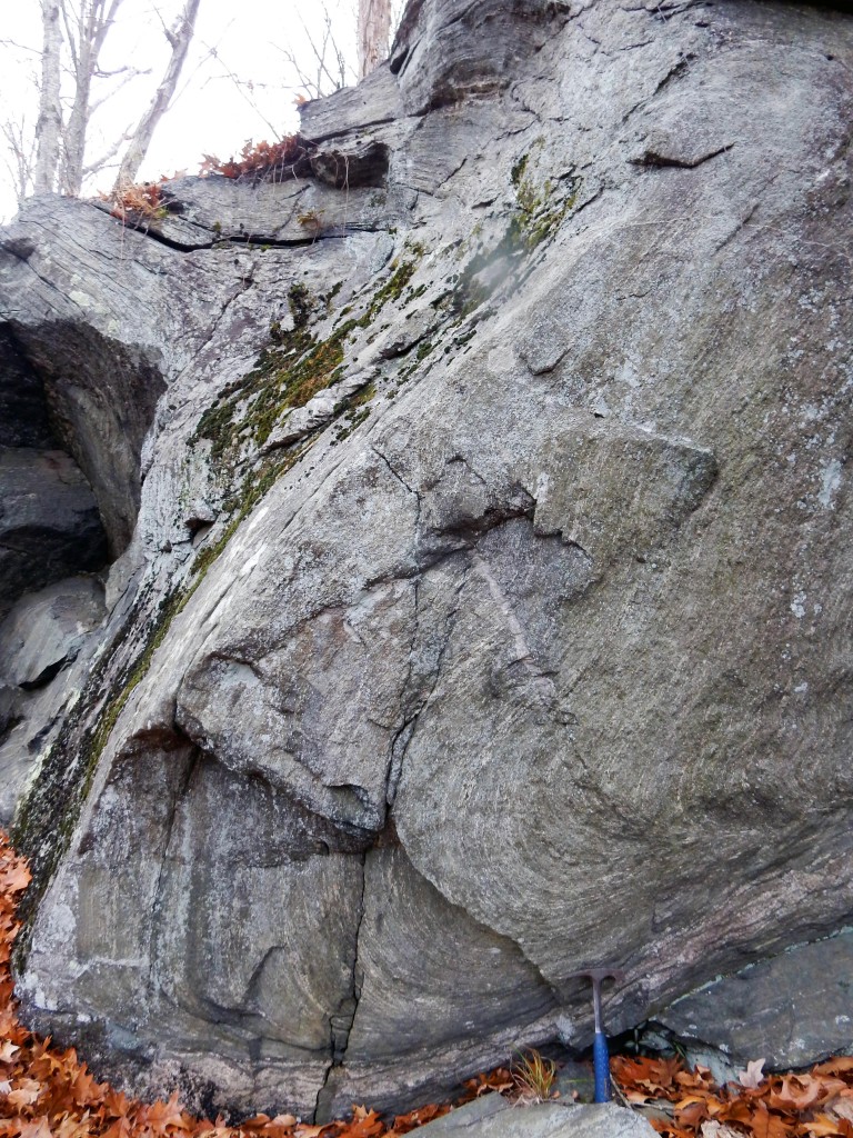
tight recumbent fold, Coventry, CT


d
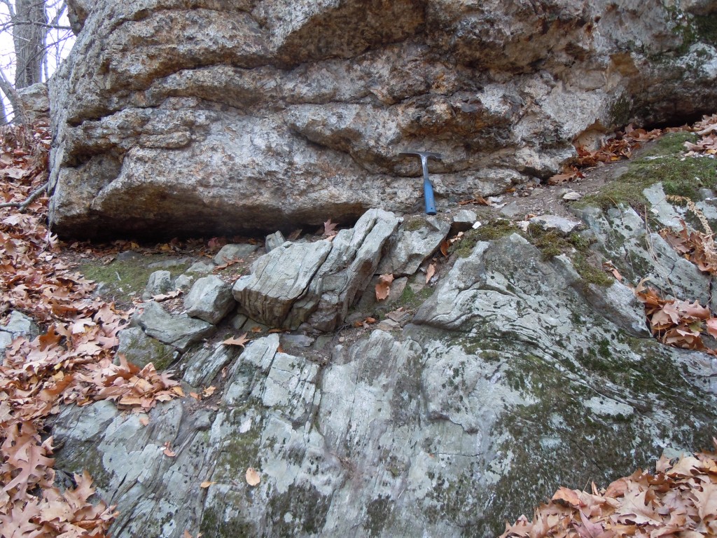
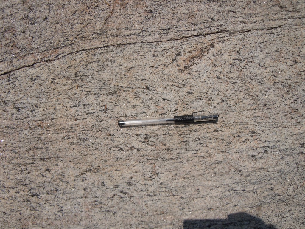
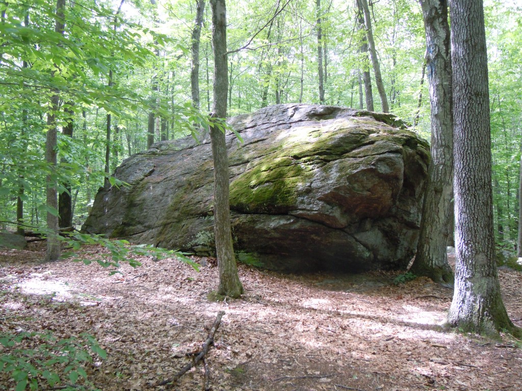
coarse-grained gneiss, Coventry, CT


d
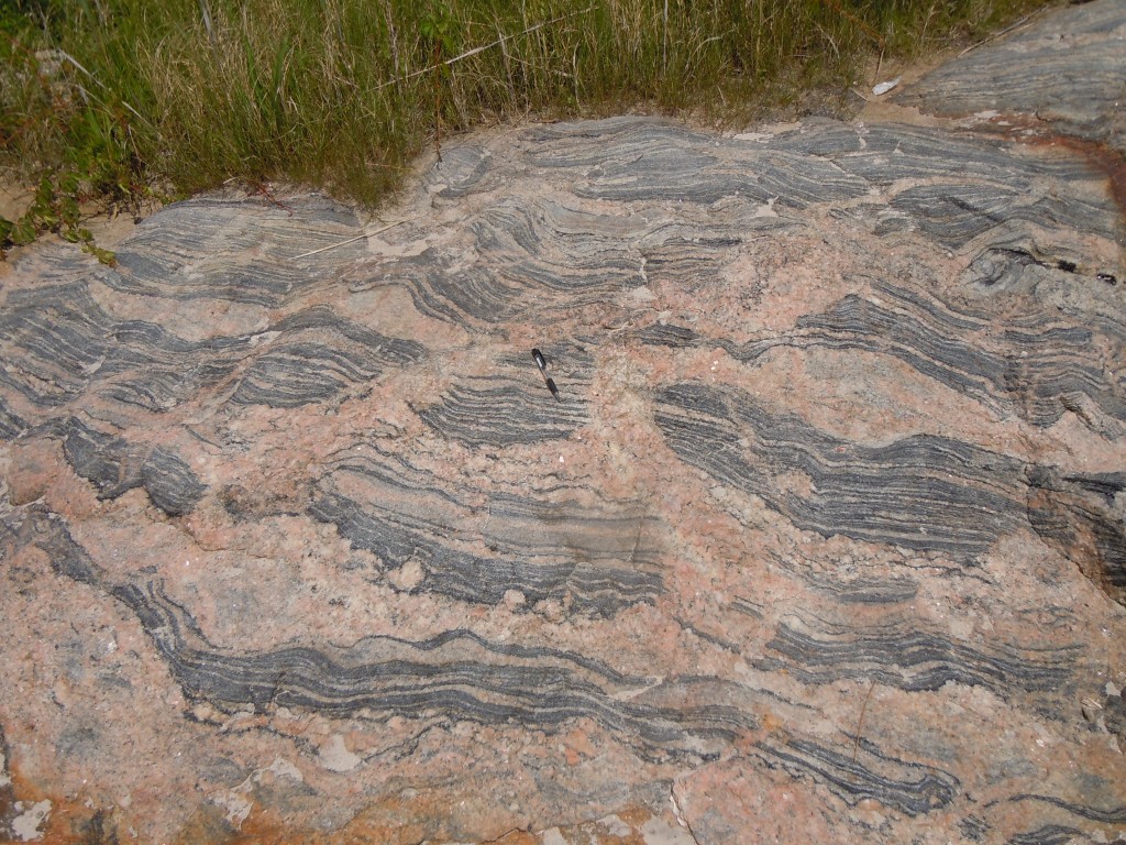
'S' fold, Lebanon, CT


d
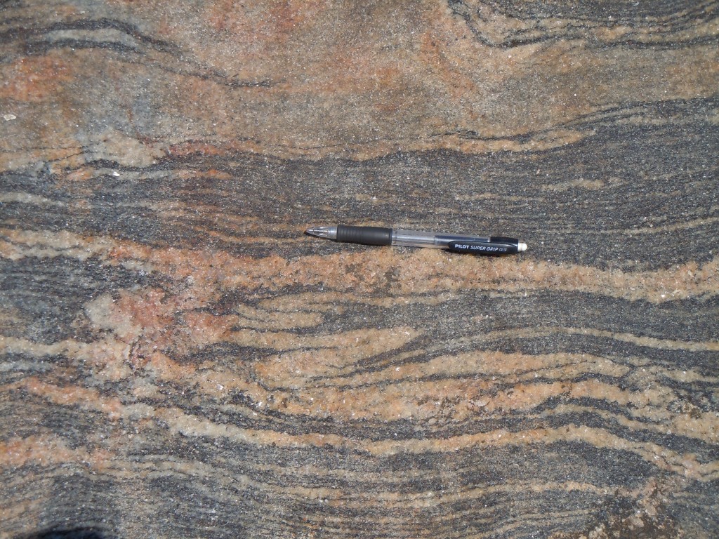
intrafolial fold, Lebanon, CT


d
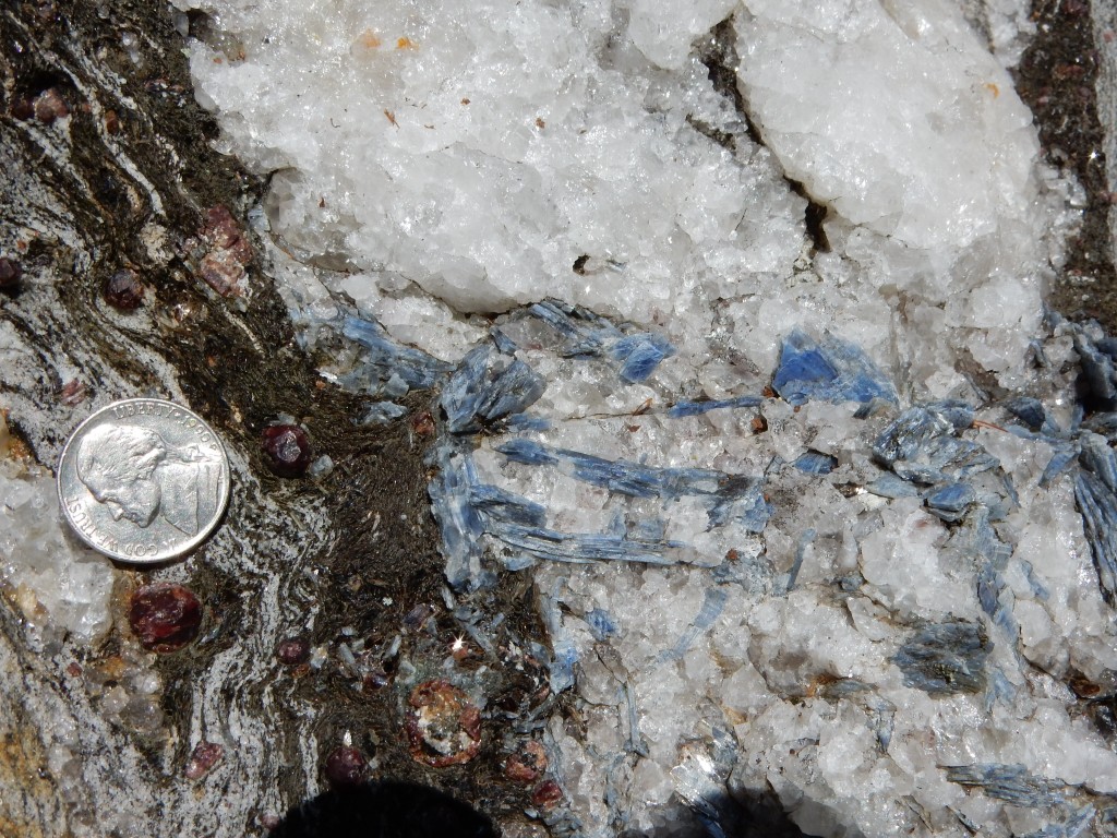
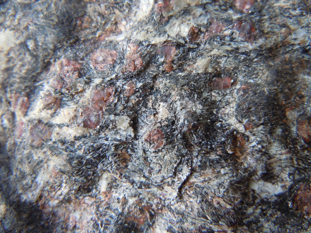
sillimanite-garnet-biotite gneiss, Willimantic


f
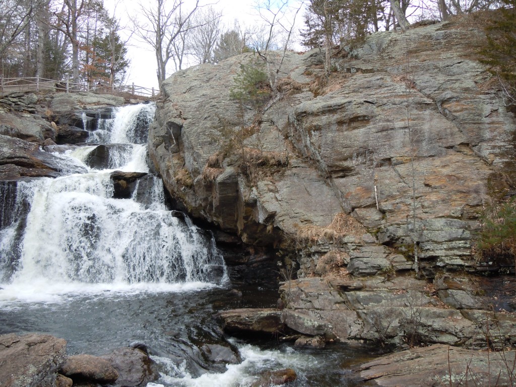
joint and foliation control on waterfall, Devils Hopyard, East Haddam, CT


f
flattened, recumbent folds, Gillette Castle, East Haddam, CT


f
Chocolate tablet boudin, Mansfield, CT


s
tightly folded gneissosity, Mansfield, CT


d
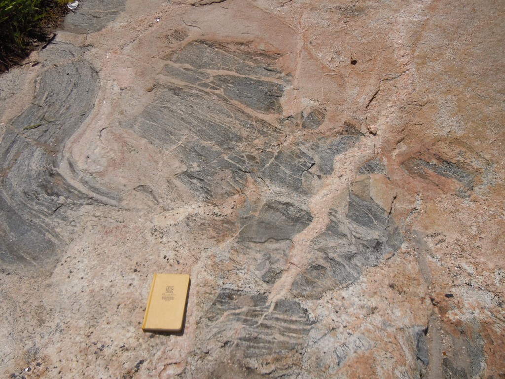
refolded folds, South Glastonbury, CT


d
complex folds in refolded zone, South Glastonbury, CT


d
tight folding in meta-sediments, South Glastonbury, CT


cd
contact between undeformed pegmatite and refolded paragneiss, South Glastonbury, CT


z
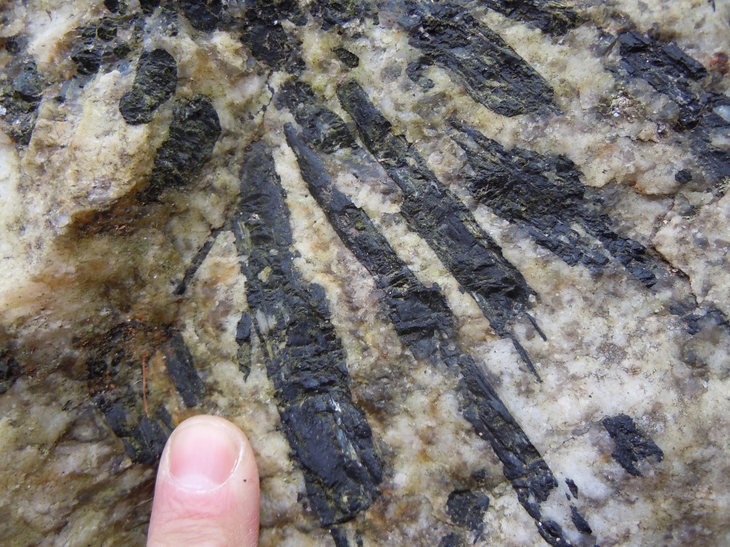
radial tourmaline (schorl) cluster in pegmatite, South Glastonbury, CT


d
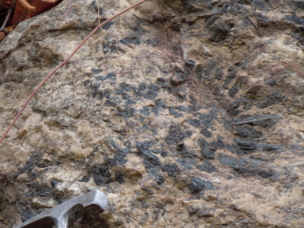
black tourmaline (schorl) in pegmatite, South Glastonbury, CT


 d
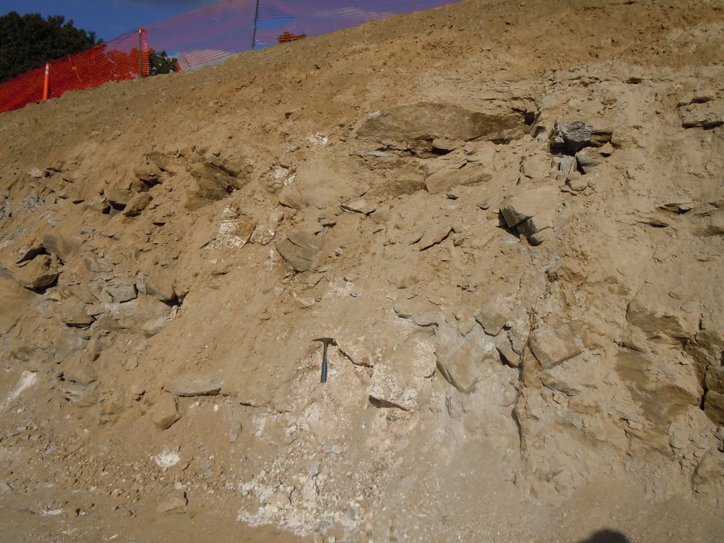
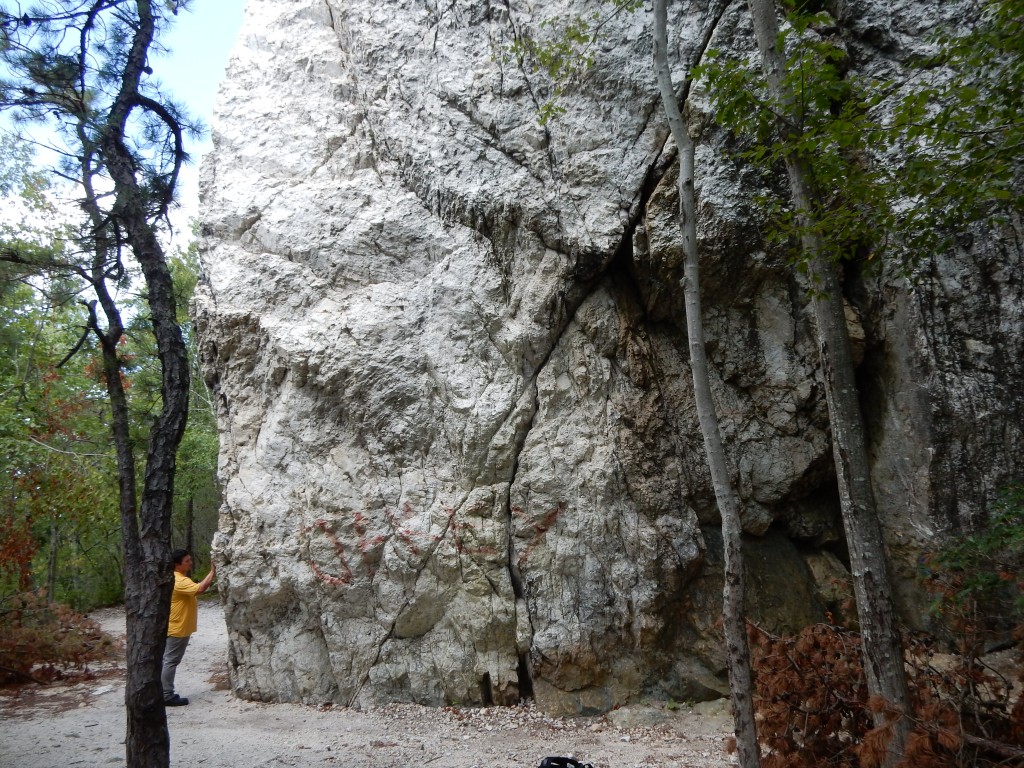
Pegmatite dike, Fine Arts Building construction site, ECSU campus, fall, 2013


x
Agmatite (intrusive breccia), Pleasure Beach, Niantic


d
Agmatite (intrusive breccia), Pleasure Beach, Niantic


s
Agmatite detail, Pleasure Beach, Niantic


v
Agmatite complex, Niantic


g
Migmatitic gneiss with layer-parallel (boudinaged) and cross-cutting pegmatites, Billow Point, Old Lyme


d
Ptygmatically folded pegmatite vein, Billow Point, Old Lyme


x
Ptygmatic folds, Billow Point migmatitic gneiss, Old Lyme


d
Folded migmatitic gneiss, Billow Point, Old Lyme


c
boudinaged migmatitic gneiss, Billow Point, Old Lyme


d
leucosome-filled boudin necks, migmatitic gneiss, Billow Point, Old Lyme


d
folded and boudinaged migmatitic gneiss, Billow Point, Old Lyme


de
foliation boudinage and localized pegmatitic leucosomes in boudin necks, Billow Point, Old Lyme


xs
boudinage in migmatitic gneiss, Billow Point, Old Lyme


fd
boudinage, Billow Point, Old Lyme


s
folded pegmatite boudins, Billow Point, Old Lyme


f
disharmonicaly folded migmatitic gneiss, Billow Point, Old Lyme


e
subtle intrafolial folds in Rope Ferry Gneiss, Waterford, CT


g
relict isoclinal hinge in Rope Ferry Gneiss, Waterford, CT


d
undeformed pegmatite cutting Rope Ferry Gneiss, Waterford, CT


s
small pegmatite filled dextral shear zone, Waterford, CT


sd
small cylindrical folds, Bolton Notch


d
curvilinear fold hinge, Bolton Schist, Bolton, CT


as
staurolite-garnet schist, New Hartford, CT


d
SE vergent overturned fold, Barkhamsted, CT


d
tight east-vergent synform with attenuated and sheared lower limb, Hebron, CT


g
Lantern Hill silicified zone, N Stonington, CT


d
steep fracture set within Lantern Hill silicified fault zone


f
vuggy quartz vein, Lantern Hill silicified fault zone


s
top-to-the-SE asymmetric quartz vein boudin, Brimfield Schist, Salem, CT


s
S-C fabrics in extensional shear zone, Route 11, Salem, CT


f
close-up of S-C fabrics, extensional shear zone, route 11, Salem, CT


g
small graben with brittle normal faults, Route 11, Salem, CT


f
brittle-dusctile extensional shear zone, Route 11, Salem, CT


g
glaciated, low-relief southern New England landscape, Farmington River Valley, Barkhamsted, CT


f
Huge glacial erratic, Days Pond, Colchester


d
Boulder Moraine, Ledyard Glacial Park